


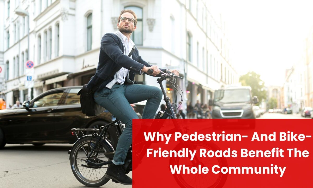
Cities worldwide now treat pedestrian- and bike-friendly design as essential infrastructure, not a lifestyle perk. In 2025, active transportation (walking, cycling, and micromobility) is central to achieving safer streets, stronger local economies, and climate goals.
Transportation remains the largest share of U.S. greenhouse-gas emissions, so shifting even a slice of short car trips to walking and biking delivers measurable impact.
Beyond emissions, redesigned streets consistently reduce severe crashes, improve air quality around schools, and generate more foot traffic for neighborhood shops—benefits that are hard to replicate with car-only approaches.
Safety first: Designs that protect people
Modern Complete Streets tools—protected bike lanes, raised crosswalks, curb extensions, leading pedestrian intervals, and daylighting—are proven to reduce crash risk for everyone, including drivers.
- Protected bike lanes lower cyclist injury risk on redesigned corridors, with city evaluations reporting ~30–50% fewer crashes after installation. On New York corridors where protected lanes were added, injuries dropped and risk fell by a third or more—especially on the most dangerous streets.
- Nationally, road deaths remain unacceptably high, but 2024 saw a notable improvement: U.S. traffic fatalities declined to ~39,345 with the fatality rate dropping to 1.20 per 100 million VMT. Pairing this macro trend with proven traffic calming and All-Ages-and-Abilities bike networks is how communities turn improvement into lasting change.
Key takeaway: If you can physically separate modes (curbs, concrete islands, or parking-protected lanes), you cut conflicts and confusion—crash risk falls for people walking, biking, and driving alike.
Health and wellbeing: Movement built into daily life
Public-health guidance is consistent: adults should aim for 150–300 minutes of moderate activity per week. When communities make everyday trips walkable and bikeable, people meet those targets without a gym membership.
- Insufficiently active adults face a 20–30% higher risk of death than those who get enough activity. Replacing short car trips with brisk walking or cycling lowers risks for cardiovascular disease and other chronic conditions.
- Mental-health evidence is catching up fast. Large longitudinal studies in 2024–2025 associate cycling to work with fewer prescriptions for depression/anxiety and lower incidence of mental ill-health. Put simply: active commutes help people feel and function better.
Key takeaway: Sidewalks that are continuous, crossings that are frequent and safe, and connected low-stress bike networks are community-wide health programs in disguise.
Cleaner air and climate resilience
Replacing short car trips is the fastest way to cut transport pollution:
- A typical U.S. passenger vehicle emits about 400 g CO₂ per mile at the tailpipe; the 2023 new-vehicle fleet averaged ~319 g/mile. Every mile walked or biked instead avoids those emissions—no apps, no incentives, just good street design.
- Around schools, School Streets programs (temporary car-free blocks at pick-up/drop-off) reduce NO₂ by up to ~23% during the rush, improving the air kids breathe and encouraging family walking and biking.
Key takeaway: Pedestrian- and bike-first streets are a climate strategy and a healthy-air strategy—especially where children and seniors spend time.
Stronger local economies and main-street vitality
Walkable, bikeable corridors reliably boost local business:
- After installing early protected lanes on Manhattan’s 8th/9th Avenues, nearby retail sales jumped ~49%, far outpacing borough-wide trends.
- In Minneapolis, a corridor reconfigured for biking saw retail employment up ~12.6% and food sales up ~52% compared with nearby controls.
- Studies in Toronto’s Bloor/Danforth corridor show more customers, more frequent visits, and no evidence of economic harm after bike-lane installation, with several indicators improving.
Why it works: people on foot and bike visit more often, linger longer, and spend locally. Meanwhile, going car-free or car-lite can save households thousands per year—AAA’s national averages put new-car ownership around $12k/year—money that can be recirculated into neighborhood economies.
Key takeaway: People-first streets are a pro-business strategy; they convert drive-through corridors into destinations.
Space efficiency: Moving more people with less asphalt
Even when a bus lane or bike lane looks “empty,” it often moves more people than a congested car lane:
- Bus lanes with frequent service can out-carry a general-purpose lane, moving far more people per hour.
- Per unit of width, cycle tracks can achieve ~1.6–2.4× the person-throughput of a car lane.
- Shared micromobility continued setting records, with 157 million U.S./Canada trips in 2023, proving the demand for short, car-replacement trips when safe facilities exist.
Key takeaway: When right-of-way is scarce (downtowns, town centers), walking, biking, and transit deliver the best people-moving ROI.
Costs and ROI: A budget-smart way to add capacity
- Highway lane expansions in urban areas can average ~$10 million per lane-mile (often more).
- Many separated bike lanes can be delivered for five to six figures per mile using posts/parking protection; concrete-curbed versions can cost more but still pencil out against highway widening.
- Federal benefit-cost guidance now explicitly values bike-lane benefits per cycling mile, enabling stronger grant applications.
Key takeaway: If the goal is to move more people safely, walk/bike facilities are among the lowest-cost capacity upgrades a city can buy.
Equity and access: Serving those with the least choice
About 8% of U.S. households have no vehicle, and many more are car-cost-burdened. People who don’t drive—children, older adults, people with disabilities or on constrained incomes—depend on safe sidewalks, crossings, and low-stress bikeways to access school, work, services, and social life.
When streets prioritize slower speeds, continuous sidewalks, accessible curb ramps, and protected bike facilities, they expand independent mobility for everyone.
What “great” looks like: Design elements that deliver
- Continuous sidewalks on both sides of the street, with curb ramps built to accessibility standards.
- Frequent, high-visibility crossings with raised crosswalks, leading pedestrian intervals, and daylighting at corners to improve sightlines.
- Protected bike lanes connected into a citywide network, designed for All Ages & Abilities (physical separation on higher-speed or high-volume streets).
- Protected intersections that slow turning vehicles and make people on bikes and on foot visible and predictable.
- School Streets and slow-speed zones around parks, libraries, and senior centers.
- Micromobility parking and bike parking at key destinations, plus secure long-term parking near homes and transit.
- Speed management (design for 20–25 mph on local/commercial streets) and traffic-calming (narrowed lanes, chicanes, raised intersections).
- Snow/leaf/debris maintenance plans so walking/biking stay viable year-round.
Community benefits at a glance (2025)
| Benefit | What changes on the street | Typical metric | 2025 headline takeaway | Example outcome |
|---|---|---|---|---|
| Safety | Protected bike lanes, raised crosswalks, daylighting | Injury crashes | ~30–50% crash reduction on redesigned corridors | NYC corridors with protected lanes show ~34%+ lower injury risk |
| Public health | Walkable grids, low-stress cycling network | Physical activity | Meeting 150–300 minutes/week is easier when daily trips are active | 20–30% lower mortality risk with sufficient activity |
| Air quality | School Streets, fewer idling vehicles | NO₂ during drop-off | Up to ~23% NO₂ reduction at schools | Children breathe cleaner air and walk more |
| Climate | Mode shift for short trips | Tailpipe CO₂ avoided | Avoid ~400 g CO₂ per mile walked/biked instead of driven | Thousands of tons avoided across a city annually |
| Local economy | Bike-/ped-friendly main streets | Retail sales/footfall | Double-digit sales and job gains common on retrofits | NYC 9th Ave retail +~49% post-project |
| Capacity | Transit & cycle priority | People per hour | Bus/cycle lanes move more people than car lanes in limited ROW | Cycle tracks deliver ~1.6–2.4× person-throughput per width |
| Household costs | Safe, car-lite choices | Mobility spending | Car ownership averages ~$12k/year; savings go local | Families shift trips to walking/biking/transit |
| Equity | Accessible sidewalks, safer crossings | Access to essentials | Better access for car-free households and non-drivers | More independent trips for kids/seniors |
Implementation playbook: How communities get there
- Network first, not one-offs. Build short, connected links that complete missing gaps (to schools, grocery stores, and transit hubs). Publish a citywide low-stress map so residents see immediate utility.
- Start with speed. Design local/main streets for 20–25 mph operating speeds. Narrow lanes, add raised crossings, and use small curb radii to slow turns.
- Upgrade intersections. Add protected intersections wherever bike routes cross arterials; install LPIs and no-turn-on-red where sightlines are constrained.
- Deliver quick-build, iterate, then harden. Use posts/paint to pilot; measure injuries, speeds, and retail performance; then harden successful pilots with concrete.
- Prioritize schools and senior destinations. Roll out School Streets, refill crosswalks, and calm traffic during arrival/dismissal. The health and safety ROI is immediate.
- Maintain like a utility. Budget snow removal, sweeping, and resurfacing for sidewalks and bikeways—not just car lanes.
- Bundle with transit. Put secure bike parking and bike/scooter corrals at bus and rail; design slow streets that feed stations.
- Measure what matters. Track crashes/injuries, mode share, retail sales, air quality, and access (e.g., % of residents who can reach daily needs within a 15-minute walk/bike).
Pedestrian- and bike-friendly roads are an all-in-one solution: safer streets, healthier residents, cleaner air, stronger main-street economies, and more capacity without endless widening.
The recipe is clear: slow speeds, visible crossings, and physically separated, connected bikeways—starting where the need is greatest (schools, senior sites, transit).
In 2025, the question isn’t whether to build for walking and biking; it’s how fast your community can deliver a reliable, low-stress network that lets everyone move freely, affordably, and safely.
FAQs
No. By shifting short trips to bikes and walking, protected lanes increase person-throughput and reduce conflicts. Streets that feel calmer and more predictable run more efficiently, and nearby businesses typically gain customers.
Build for safety and continuity, and people show up. North American systems logged hundreds of millions of shared bike/scooter trips, and corridors that connect homes to schools, jobs, parks, and shops see steady ridership growth once the comfort gap is closed.
Compared with $10M+ per lane-mile for highway widening, protected bike lanes and walking upgrades are low-cost capacity that also cut crashes and emissions. Many cities deliver quick-build networks for five to six figures per mile, then harden the most successful segments.